|
|||||
|
|||||


|
Space pictures of Nepal, Tibet and the Himalaya
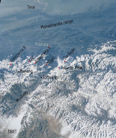
The valley of the Kali Gandaki river
"Image courtesy of Earth Sciences and Image Analysis Laboratory, NASA Johnson Space Center." See http://eol.jsc.nasa.gov, Part of Picture STS 099, adaption Andrees de Ruiter www.nepal-dia.de On the left you see the annapurna range with the manang valley. On the right the Daulagiri range. The Kali Gandaki is one of the three rivers who cross the himalayas. IIts one of the deepest geaorges in the world.
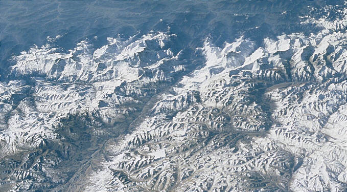
"Image courtesy of Earth Sciences and Image Analysis Laboratory, NASA Johnson Space Center." See http://eol.jsc.nasa.gov, Part of Picture STS098-703-98, adaption Andrees de Ruiter www.nepal-dia.de Back to the overview Space Pictures of Nepal
These pictures are kindly provided by the Nasa Johnson space center and you can download free more than 40000 of them. I myself made the selection, some adaptions and added names. Feel free to add them to your own hompage, but please add the credit as mentioned below of each picture.
|
|||||