|


|
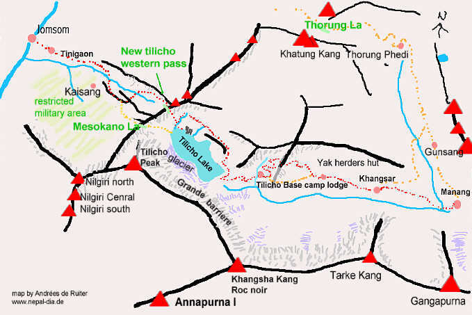
Trekking to the Tilicho lake trough the village of Khangsar and crossing to Jomsom by an other pass than Mesokanto la with many pictures, photos and a map of the Tilicho lake area.
Instead of taking the valley north directly to theThorong la you can continue the main valley to the west and have a side trek to Tilicho lake. Dont believe some old leaflets writing that it is a one or two day trek, they where written when there was a path leading along the river. This was washed away in 1997 and will not be repaired. Ideal would be if you allow yourself 3 1/2 days from Manang.
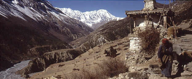
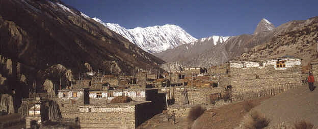
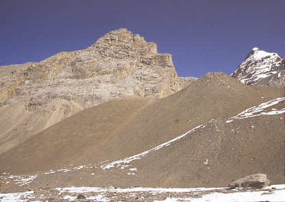
trekking to Tilicho lake First you have to go for about 3 hours to the wonderful village of Khangsar, a village still in the old Tibetan style.
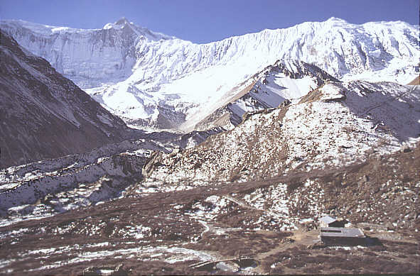
the village of Khangsar at 3700 m, in the backround you see the grande barriere. Going to the tilicho base camp lodge From there you reach in 6 to 8 hours Tilicho base camp lodge. The Tilicho base camp lodge is managed by the people of Khangsar. Be sure that it is open by first asking in the village. First you pass a nice Gompa.
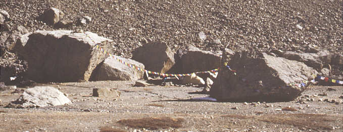
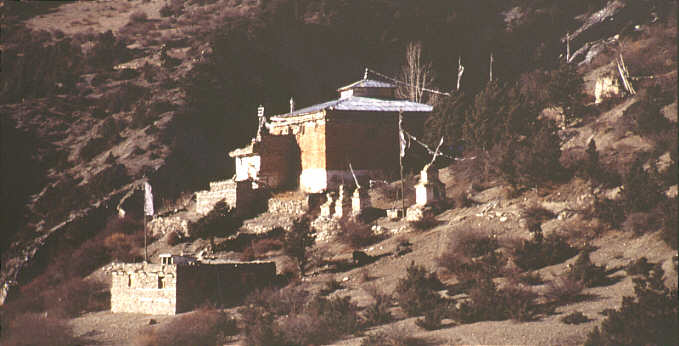
Thare Gompa
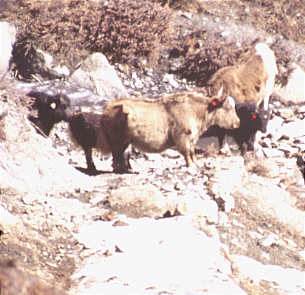
Cuntinuing you will reach a little yak herders hut. The yaks dont like to stay below 3500 m and the summer pastures arond tilicho lake are very rich.
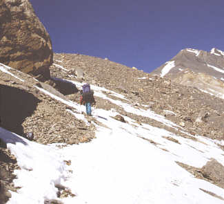
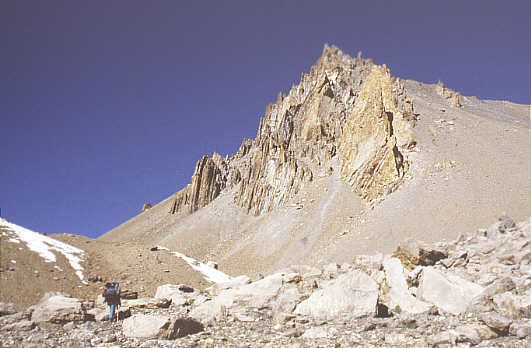
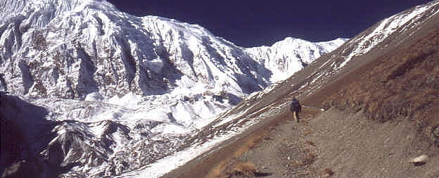
Shortly after the hut there are two trails. The safe one climbs up for some hundred meters to the ridge, only to go down again ~ 700 m to the lodge. The other one is continuing more or less at the same level but is passing on very step slopes of loose gravels and is pretty dangerous. Considering the benefiting aspect of climbing on 4700 m for you acclimatisation and the safety I would recommend the upper way.
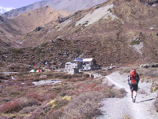
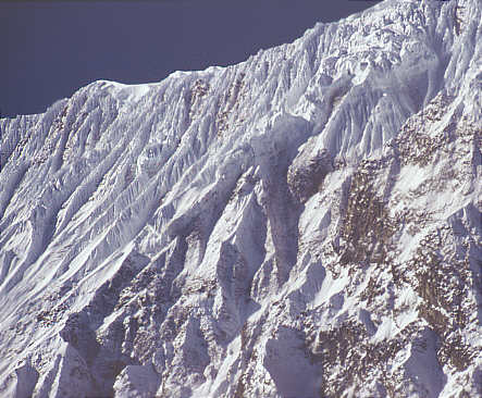
Photo David Donaldson, the middle trail is going just blow the rocks in a loose gravel slope, in the background one can see the trail going up to Tilicho lake and the Grande Barriere with Tilicho peak.
The Tilicho Base Camp Lodge ist at 4000 m. When you stay here two nights in total, you
In 2003 Tilicho base Camp lodge is already nearly a palace. Photo David Donaldson
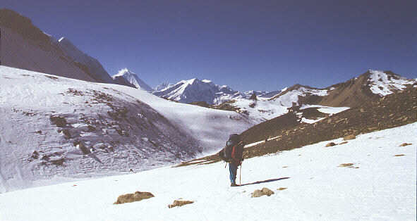
From the lodge its another 4-5 hours to the lake, which is situated at 5000m below Tilicho peak.
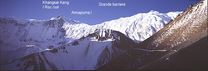
Khangsar Kang can also be seen from Annapurna Sanctuary.
The Grande Barriere
So they where looking for an aproach to Annapurna I. On their only map, an indian one, it looked as if there was a posibility to go directly from the tilicho lake. Two of them went to Tilicho lake and then to Manang to get some food. But the manang people where so poor and nearly starving themselves, that they could not get a single little bit of food. And they had to realize that between them at tilicho lake and the Annapurna I was a tremendous wal of rock an ice. The called this enormous ridge la grande barriere the great barrier. After that they returned very hungry and disapointed to Tukuche.
It also can be seen from the other side at the Annapurna Base Camp!
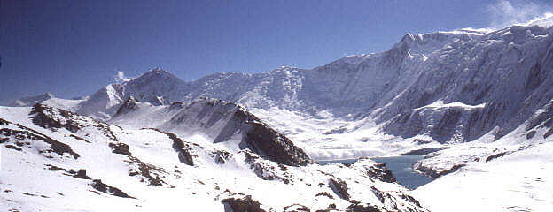
Tilicho Lake seen from space by NASA astronauts
Mountains: 1) Annapurna I, 2) Tilicho peak, 3) Khangsar Kang or Roc Noir,
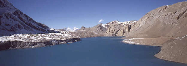
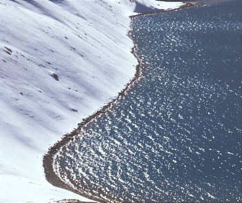
Tilicho lake (4919 m) in October
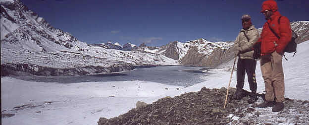
Tilicho lake in December, there was a stormy and icy wind at -15°C, so that we just could stay for some minutes.
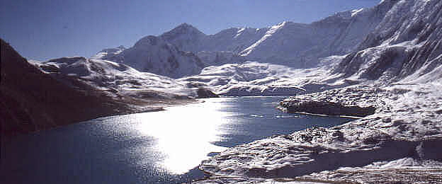
Magic Tilicho Lake in mid march 2001 Photo Richard Beatson Count some hours just to stroll around and enjoy this exceptional site and you have enough time to go back to the the lodge. Going to the lake and back the same day to Khangsar is possible, but you will not have the time and spirit to enjoy this magic place. People I met, who tried this, could not reach Khangsar at time and had to stay a whole night outside. After tilicho lake, you acclimatisation will be probably perfect, (as long you have not got problems), so you can go straight from Khangsar to Thorong Phedi in one day and Thorong la will be just a nice walk!
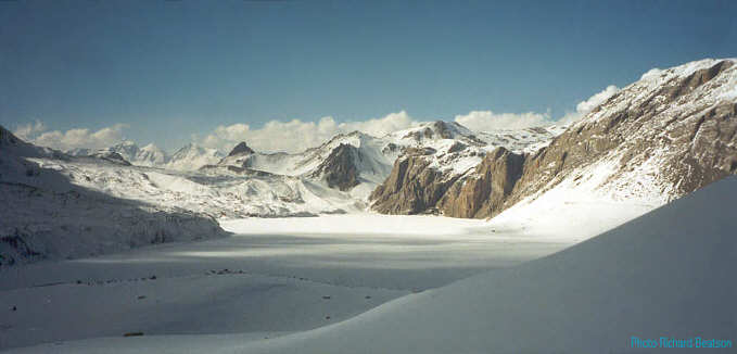
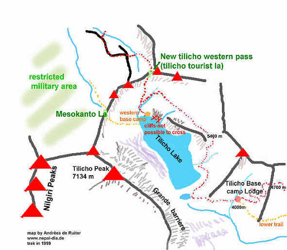
It is not possible to go around the edges of the lake. One has to climb up to 5400m to go north of a big wall. To cross tilicho lake into the Kali Gandaki valley is a full scale alpine expedition and you need a tent, stove and food for 3 days.
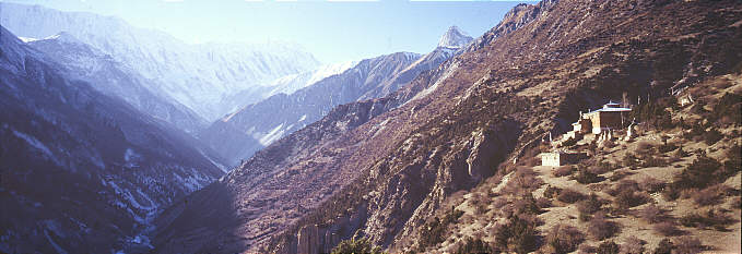
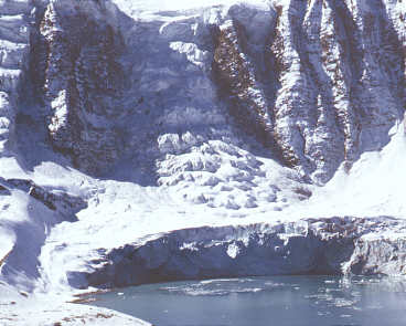
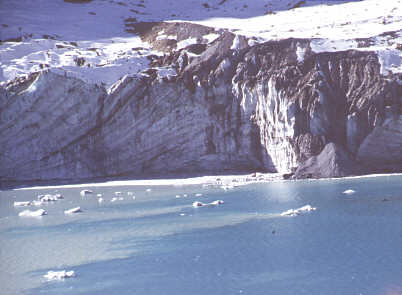
The glaciers from tilicho peak ar going right into the water Going from Khangsar directly to Thorong Phedi There is a direct trail. It starts in Khangsar and first leads you to a little village just habitaded during the summer months. The trail continues till a terrific view point, from where you can see tha mountains Khatung und Yakawa khang (inbetween is thorung la) and the whole Manang valley. From this viewpoint you have to look down in to the valley leading to thorong Phedi and you will see the trail going gently down through liitle (birch) forests. It will cross the river coming from thorong phedi a little bit north of Gunsang. After that you just continue on the standad trail. It will take you about 6-8 hours. Crossing from the tilicho lake into the Kali Gandaki Valley
To cross from tilicho lake into the Kali Gandaki valley is a full scale alpine expedition and you need a tent, stove and food for 3 days.
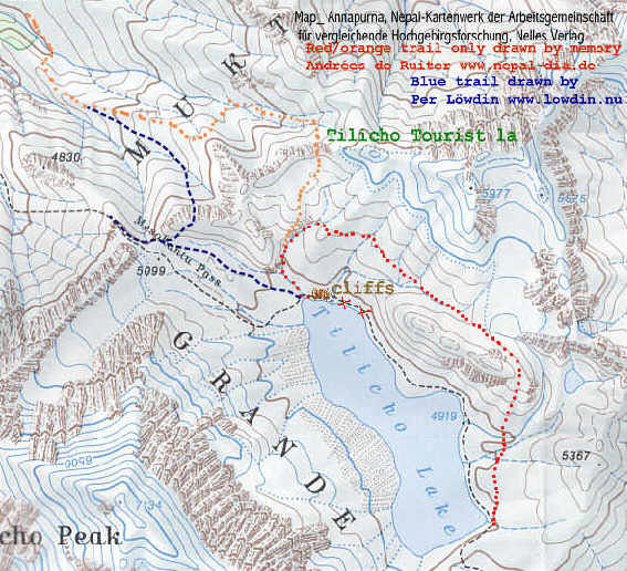
Please notice that the trails are only drawn by memory in a large scale map.
In most trekking books or on internet travellogues you will find a trail description by the mesokanto la, allways with a warning, that you will go through a restriced military area and may be sent back. Obvisioully there is now also a possibility to cross mesokanto la and go to the northern side of the valley avoiding to go throug the military area (blue trail). See Per Löwdin s website Tilicho Lake . When I was trekking in 1999 with my friend and Porterguide Bachan , we where told that there is a new possibility to cross the ridge separating the tilicho lake from the Kali Gandaki Valley. I call this pass Tilicho tourist la or New western tilicho pass. You will find an excellent trail build by mountain expeditions on their way for climbing Tilicho peak. How to go Starting point is the Tilicho base camp lodge. If you start very early ( 4-5 am, like in the alps), you could cross directly the same day to the western part of the lake. i prefered to camp on the eastern side On most of the maps you will see trails going along the south and the north-shore. This is not possible for normal equipped trekkers. The south trail would lead over 2 km of glacier with crevasses, so you need alpine experience, crampons and a rope. On the north western part of the shore you will find cliffs falling directly into the lake.
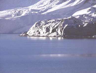
Cliffs barring the way along the lake shore
behind the ridge at 5350 m
Continue to go west but be very carefull, not to go down to early. It looks as if you could go direcly to the lake along this little valley, but this will just lead straight down and reach the lake before the cliffs! In 1999 there where some cairns leading to the right trail which is going slightly north. it is only when you are near to the western end that you can descent to a little river, this will lead you to the western side of tilicho lake. Protected by some enormous rocks is the western tilicho base camp, a very little camping site.
my little tent at the western tilicho base camp
Crossing by the tilicho tourist la. The next morning you have to go back along the little northern river where you where coming the day before. Soon there is a very thiny trail climbing up to the western ridge.
Climbing up to the pass
From the Tilicho tourist la you can have a look far into Tibet and mustang. Continuing after the pass. There is an exellent trail going down to the little river. There it suddently stops and you just see many little cattle trails along the grasy slopes. Dont follow the river but climb the eastern slopes. When you are up to the plateau, you should see some big cairns. There are two ridges descending near the river. Take the left (eastern) one and follow the trail with big cairns. After crossing the river again just follow the main trail. From now on you can see Kaisang and the restricted military area. Pass the little goat farm till you reach the beautiful village of Thinigaon or just Thini. From here you can see Jomsom wich is just 45 min away. It took me about 10 hours from the Tilicho tourist pass to Jomsom My shedule was: Day 1: Manang-Khangsar, start 2 pm Day 2: Khangsar-Tilicho base camp lodge Day 3: Tilicho base Camp lodge- Eastern side of tilicho lake Day 4: eastern to western side of tilicho lake Day 5: Western side of tilicho lake- New tilicho tourist la- camping site Day 6: camping site- Jomsom arrival at 4 pm equipement: tent, stove, rara noodles for everys day -breakfast and dinner ( they are precocked, so you can cook them even above 5000 m, but i didn t wanted to eat noodles for the next two weeks), no crampons, no ice axt, no rope. Shedule Sidetrek: Manang Khangsar 3-4 hours Day 1: Khangsar-Tilicho Basecamp lodge Day 2: Tilicho Basecamplodge-Tilicho Lake-back to lodge Day 3 TBC-Lodge- Khangsar Day 4: Khangsar-Thorong Phedi Day 5: Your aclimatization is just perfect and you will walk over Thorong la whistling some tunes. An excellent web site for Tilicho Lake is from Per Löwdin from Norway See also Liruns site Tilicho with many photos and information Picture Galery tilicho german DAV Tilicho expedition 2000
Dutch Tilicho peak expedition 2002 Singapure Tilicho expedition 2000 hike toward tilicho lake and missing it by 5 minutes german slide show by Rolf Gyufko two Austrians climbing Tilicho Peak and flying to jomson by paraglyde! Update 2002 by David Donaldson: From Manang it is 2-3 hours to Khangsar where there are several lodges. One as you enter Khangsar and several more around the square a bit to your right. A bit basic but
OK.
Photos and maps copyright by Andrées de Ruiter. But you can use them in your personal hompages if you want. Please credit me like this: Picture by Andrées de Ruiter www.nepal-dia.de For the map with the trails pleasw credit me and Per Löwdin www.lowdin.nu
|
|||||||||||||||||||||||||
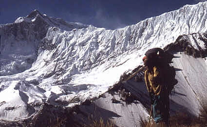 The Grande barriere is a ridge
full of ice. From the black mountain Khangsar Kang in the background is leading directly to the Annapurna I.
The Grande barriere is a ridge
full of ice. From the black mountain Khangsar Kang in the background is leading directly to the Annapurna I.
 In 1950 a french expedition led
by Maurice Herzog went to Nepal to be the first summiter of a 8000 m peak. They where based in Tukuche and where trying to find an ascent to Daulagiri. But soon the realized, that it was not
possible (But they found the french pass!)
In 1950 a french expedition led
by Maurice Herzog went to Nepal to be the first summiter of a 8000 m peak. They where based in Tukuche and where trying to find an ascent to Daulagiri. But soon the realized, that it was not
possible (But they found the french pass!)
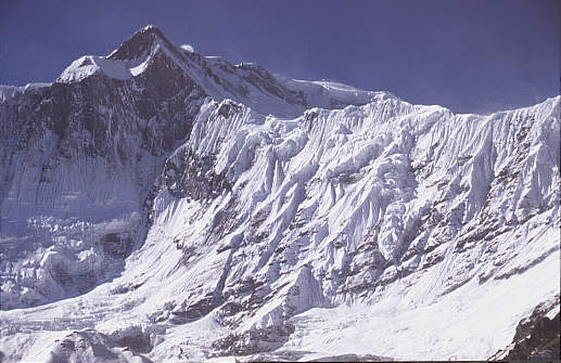 At Khangsar Kang the grand barriere
and the Annapurna ridge are touching. The french name Roc noir means black roc . it is so steep that no snow can hold on it.
At Khangsar Kang the grand barriere
and the Annapurna ridge are touching. The french name Roc noir means black roc . it is so steep that no snow can hold on it.
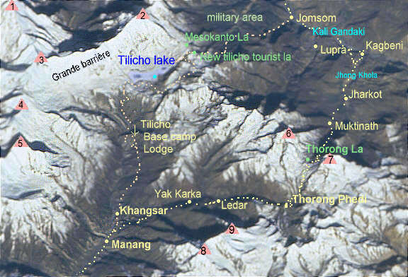
 This part of the map was kopied from the excellent german Schneider Map from
Nepal Kartenwerk der Arbeitsgemeinschaft für vergleichende Hochgebirgsforschung. It is sold by Nelles Verlag and is still my favourite map of the Annapurna Area.
This part of the map was kopied from the excellent german Schneider Map from
Nepal Kartenwerk der Arbeitsgemeinschaft für vergleichende Hochgebirgsforschung. It is sold by Nelles Verlag and is still my favourite map of the Annapurna Area. 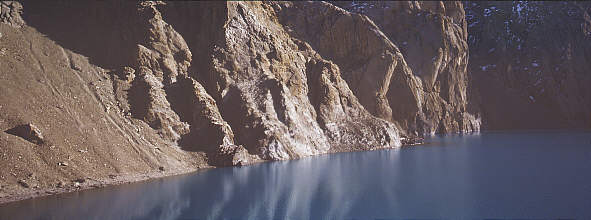
 Therefore one has first to climb
behind the big redish rock ridge north of the lake. The trail begins allready a little east of the lake and you will see some cairns. After a climb of 400 m You will be behind the ridge. Continue to go west but
be very carefull, not to go down to early. It looks as if you could go direcly to the lake along a little valley, but this will just lead straight down and reach the lake before the cliffs! In 1999 there where some
cairns leading to the right trail which is going slightly north.
Therefore one has first to climb
behind the big redish rock ridge north of the lake. The trail begins allready a little east of the lake and you will see some cairns. After a climb of 400 m You will be behind the ridge. Continue to go west but
be very carefull, not to go down to early. It looks as if you could go direcly to the lake along a little valley, but this will just lead straight down and reach the lake before the cliffs! In 1999 there where some
cairns leading to the right trail which is going slightly north.