|
 Nepal, Trekking around Annapurna - the Manang side Nepal, Trekking around Annapurna - the Manang side 
On this page you find informations and pictures of the trail from Chamje to Tal

you can enlarge most small pictures by clicking in on of the corners.
If you want to see a picture in full sizze, click additionally on F11
NATT 07 Chamje to Tal

At the end of Chamje the road continues straight on the right riverside. Fortunately the
NATT trail branches of to the river and you can continue on a beautiful natural NATT trail

the bridge over the Marsyangi River
 
Two monsoon pictures. in a deep gorge a landslide resulted in a huge natural dam. In
the dry season the water will folw throught and under the big rocks but in the rainy season it comes down as an torrential white water river. Notice on the left picture the road high above the river
 
In December, the grass is dry and brown, but the poinsettias are flowering :-)
 

After walking with on typical Nepali ukkalo- oralo trail (permanently up and down ) one
finally has climb the step slope leding up to the top of the dam/barriere. This can be very hot, but fortunatelly there is a teashop in the middle so that you can cool down with a cold drink.

at the end of the climb you reach the entrance gate
 
When you pass the police post on top of the dam you will look down to a large flat area with the village Tal.
 
work in Progress .........
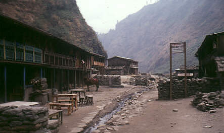
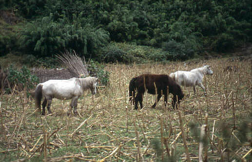
In the neinties he village of Tal looked a little bit like a little wild western town. The area is famous for their littles but strong horses.

Tal in 1998
Nowadays many new lodges haave been built and Tal looks quite similar to like the other villages on the AC
    

At the end of Tal there is a marvellous waterfall o faround 200 m hight.
 
potato harvest
Overview Annapurna region

Jagat to Chamje  Tal to Dharapani Tal to Dharapani
  To the page To the page
NATT- guidebook and maps
|