|


Nepal Maps of Himalayan Map House at Amazon UKWhen i started to mark the NATT trails with my friend Prem in the Annapurna region we went to the two major map editors to tell them about the new trails. When we told about this to Pawan Sakya from Himalayan Map house / Nepal Maps he directly phoned to the printer and told him, to stop printing the Annapurna Map and wait till a new on will be edited. So two weeks later a brand new and updated edition was printed with the new NATT trails. Since then I’m am in a close cooperation with HMH. And the maps of Annapurna, but also the jiri EBC Maps have been updated with GPS DATA I collected on trekking tours. I’m selling now various Maps of HMH at Amazon UK. Here is an overview. See more information for each map at Amazon The maps are shown from west to east-
all Nepal country map
Nepal from West to east and south to north! Showing the main roads and the whole mountain area Amazon UK West Nepal
NS 517 Hidden Himalaya scale 1:90,000 Amazon UK NS 506 Dunai to Rara Jumla Maßstab 1,150,00 Amazon UK NS 514 Dhorpatan hunting Reserve This Map shows the region between central nepal and the Annapurnaregion. It shows the lower trail to Dolpo. Amazon UK
Dolpo and Dhaulagiri treks
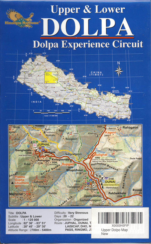
Dolpo, the land of Bon 1:125,000 Eastern dolpo with the northern trails till Annapurna .Rückseite der Karte Amazon UK ‘NE 513 Dolpo Circuit (2012) 1:125,000. Dolpo circuit. The map sows various trails in western Dolpo with it famous Phoksundo Lake Amazon UK NS 501 Dhaulagiri Circuit Amazon UK
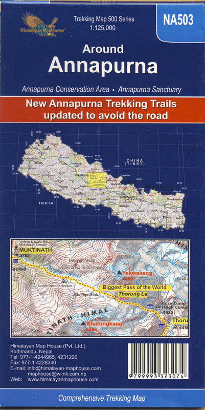
NA 503 Around Annapurna 1:125,000 . With the newest NATT trail updated 2016 . (Rückseite der Karte) Amazon UK
NA 518 upper and lower mustang 1:90,000 (2016) Amazon UK NA 510 Upper Mustang 1: 100,000 (2016) -identical information then NA 518, just a little bis smaller.Amazon UK NAAR Phu Till now Jjuly 2017) the new NA 503 Annapurna map is the only wher the traisl are correctly drawn. But it is nice to have a larger scaled ma ist die einzige Karte, in der die Wege richtig eingezeichnet sind die NA 503 Annapurna Circuit. Trotzdem ist es natürlich schön, zusätzlich eine Karte in größerem Maßstab dabei zu haben
NA 721 New Nar Phu Circuit,/ Annapurna from Manang 1:125,000. upper Marsyangi valle with Manang, and special trails in the Naar Phu valley Amazon UK CL806 Pisang & Chulu Peaks 1:50.000 (2013) ‘The upper Marsyangi Valley with the aproach routes to pisang Peak and the chulus.. Amazon UK
Treks south of Annapurna
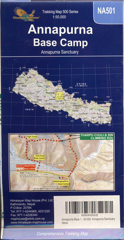
NA 501 Annapurna Base Camp Maßstab 1:50,000 . (2016) t (Rückseite der Karte) NA 522 Mardi Himal Trek, Maßstab 1:50, 000 Amazon UK NA 505 Pokhara to Ghorpani Ghandruk 1:50,000 Poon hill, with the full Kopra Danda trek. updated with my GPS DAta from 2016. As HMH has used the old ISBN Number you might get older maps from other sellers. Amazon UK Manaslu , Tsum Valley
NS 505 Manaslu & Tsum Valley. Maßstab 1:125,000 Amazon UK NS 521 Manaslu Base Camp 1:60.000 The upper Part of Manaslu circuit. The lower part is shown
in a separate little map. This map is ideal if you don’t want to go to Tsum valley. Amazon UK Ganesh Himal
NS 502 Ganesh Himal und Tsum Valley Amazon UK NS 512 Ruby Valley trek & Ganesh Himal Maßstab 1:100,000 Amazon UK Langtang & Helambu Since 2016 you can trek again in the Langtang valley
As the old trail was partialy destroyed the old maps are not anymore accurate. With the new trail in the Langtang Valley Amazon UK
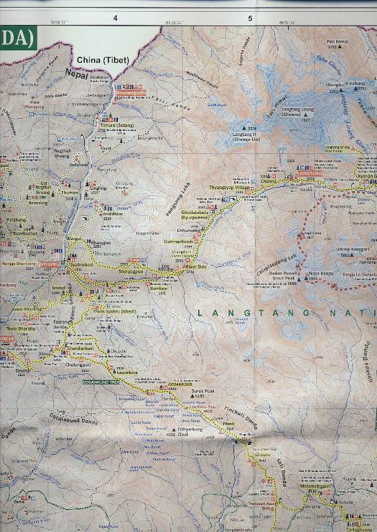
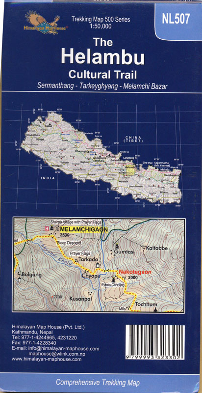
NL 511 Langtang, Gosainkund, Helambu und Tamang Heritage trail . Amazon UK Good map for the Tamang heritage trail which was not destroyed by the earthquake. For Langtang valley use the CL 819 t. Bild Karte Langtang, Bild Tamang Heritage Trail, Amazon UK NL 507 Helambu Maßstab 1:50.000 Die Karte deckt das helambugebiet von Kathmandu aus kommend ab. Der Laurebina la ist mehr mehr enthalten, so dass man für die Überquerung zu den Gosaikundseen zusätzlich die Langtang & Helambu Karte mitnehmen sollte. Rückseite der Karte Amazon UK Rolwaling Trekking is again possible after the earthquake
Ne 512 Rolwaling Amazon UK
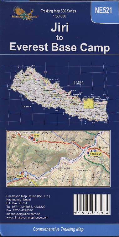
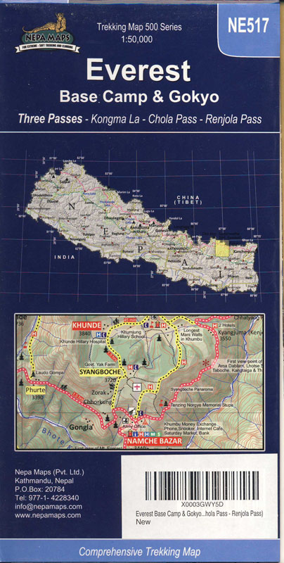
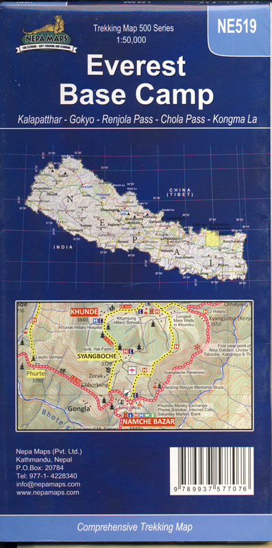
NE 521 Jiri to Everest Base Camp. Maßstab 1:50.000 double sided. A perfect map. My favorite. NE 517 Everest Basecamp & Gokyo three passes M 1:50.000 Lukhla to Gokyo and EBC Renjo La, Cho La and Kongma la . Mit dem Renjo La. NE 519 Everest Base Camp Maßstab 1:50.000 Lukhla to Gokyo and EBC With Chukung and Island Peak but without Renjo La.
NE 503 Lukhla to Gokyo 1 : 55.000
NE 502 Everest & Gokyo 1:60:000 (Aug. 2016) This map is identical with NE 517 but printed a little bit smaller. Amazon UK NE 508 Jiri to Everest 1:100.000 (2014) Amazon UK K East of Khumbu
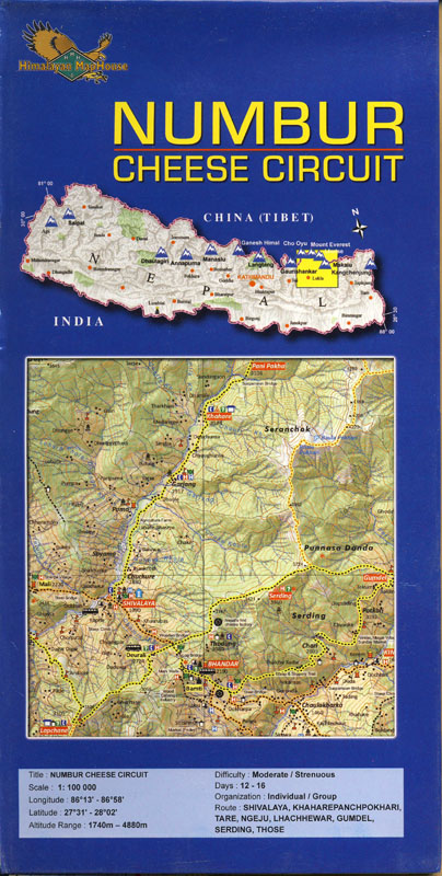
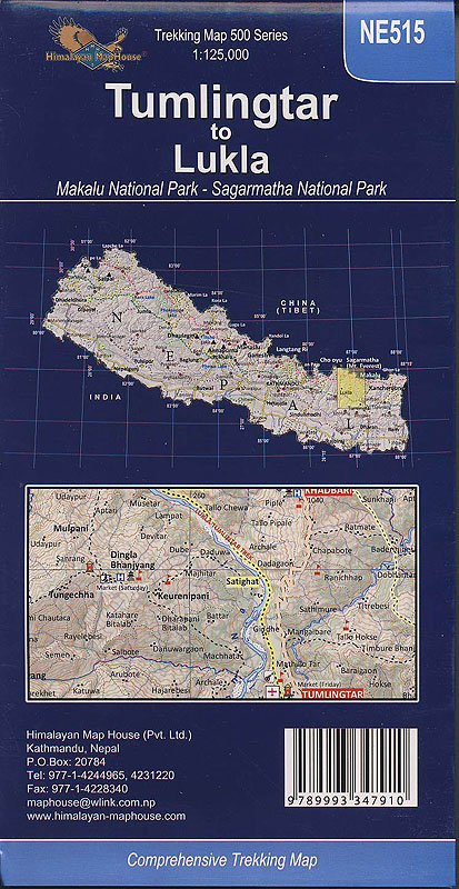
Numbur Cheese trek & Rowaling 1:100.000 Rückseite der Karte Amazon UK NE 515 Tumlingtar to Lukhla. 1:125.000 . Rückseite der Karte Amazon UK
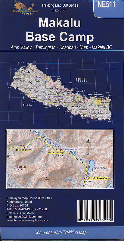
NE 511 Makalu Basee Camp 1:80,000 Trekkingkarte NE 511 Makalu Base Camp NE 518 Lumbasumba Pass, Makalu & Kanchenjunga 1:125,000 Amazon UK this Map covers the whole region between Makalu and Kanchenjunga and in between the Lumbasumba pass which is part of the great Himalayan Trail Amazon UK Kanchenjunga , 1:100,000. Amazon UK
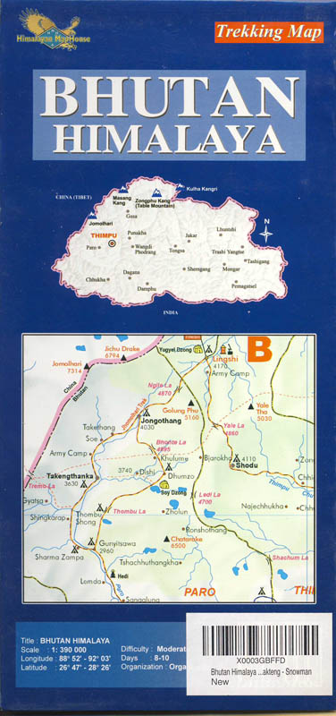
Maßstab 1:390,000
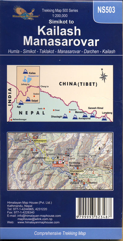
Tibet Kailash, Manasarovar & Simikot
CR 707 Lhasa to Kailash Roadmap 1:2.400.000 You will love it, when you travel through Tibet! Amazon UK NS 503 Kailash, Manasarovar & Simikot Rückseite der Karte Amazon UK
|


 CL 819 the first map after the earthquake!


