|


|
Nepal, Trekking around Annapurna - the Manang side
you can enlarge most small pictures by clicking in on of the corners. On this page you can enlage just some ot the pictures NATT trail No 35: Crossing Thorong La from Thorong Phedi to high camp to Muktinath While many groups set off between 2 and 5 a.m., this is not really necessary. You can easily cross Thorong La even when you start at around 6 am. Especially in the winter months, starting too early can be very dangerous as it is still very cold and the risk of frost injuries (frostbite) is high before 5 a.m. A German trekker I met once in December left the lodge at 2 a.m. with an organized group. On the way up to Thorong La he realized that he had cold feet but later in Muktinath he had swollen feet like an elephant and both were frozen! Fortunately after a few days in a Kathmandu hospital bed, he recovered but it was 6 weeks before he could wear his normal shoes.
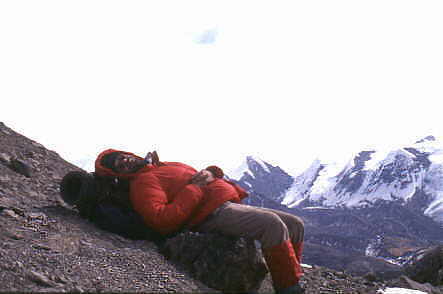
My first successful attempt to cross Thorong la in 1990
Thorong Phedi is situated at the end of the valley at 4400m. During the day it is nice warm in the sun, but in the night in can be really cold.
It’s a hard climb up and it takes around 1-1.5 hours. All the lodges in High camp are now owned by one landlord. Unless one is well acclimatized it is not recommended to stay here for the night, as the possibility of developing AMS is higher than when staying at Thorong Phedi. But for people with a good acclimatization( high route to Ngawal, Ice lake, Khangsar and one night in Churi Lethar) high Camp is the perfect choice. You can start much later in the morning after a relaxed breakfast, the viewpoint behind the lodge is absolutely worth the 20 min climbing and you journey to Muktinath is much shorter. Just be careful to descent to Thorong Phedi if you develop any even light signs of AMS. If you stayed in Yakkharka the difference in altitude is to high and you should refrain from sleeping in High Camp. Behind the lodge there is a long ridge with an awesome view at the top. Not only you can see Thorong Phedi deep below the rock wall, but you have a perfect view on the Chulus, the Annapurna Range and on the very right corner of the panorama you can even see Annapurna I. It will take you 20 min to go up and return.
High Camp 4925 m
Thorong Phedi high Camp at 4750 m
Annapurnarang3 seen from the viewpoint at the end of the ridge behind high Camp: in the left/middle part Annapurna 3 and Gangapurna, the little black peak on th eright is roc noir aka Khangsar Khang. From it the ridge is continuing to Annapurna 1
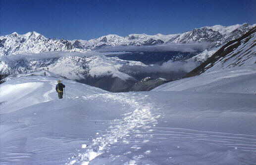
leaving high camp for a long and exhausting journey The trail climbs gently behind High Camp and after around 25 min you will reach a little iron bridge. Look to your left side to the mountain; nearby you will see a glacier coming down. After the bridge you have to climb a ridge, on the top of which you can see also Annapurna II.
25 min after the bridge you will come to a teahouse situated at about 5000 m.
Ther trail seems to be endless and everyone is so slow! When there are good weather condition the trail is very easy and has no technical problems. Many times one will think, that he already can see the pass but its only the 14th time that the real pass with the prayer flags will appears. There is a little teahouse at the pass selling tea or noodle soup and even dal bhat. (Beware – even noodle soup may take 45 minutes to prepare!) Allow yourself at least 30 min at the Thorong La as it is a wonderful place to enjoy your achievement. In any case, you want to have some pictures from this vantage point.
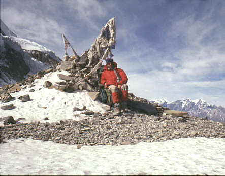
Finaly the pass appears
The pass with the little teahouse
Tibetan and Nepali people put a stone on the pile with the flag pole and say “la so so..” For the gods being grateful the gods permitted them to cross the pass. What a difference to us Westerner proudly proclaiming ”I did Thornong La!!!!
A last view back whith Chulu and Annapurna 2 & 4
Weather can change within a day from sunshine to snow storm! The mules caravans now also crossing Thorong La When i crossed Thorong la in 2011 i was completely puzzled when suddenly a large mule caravan was coming up. This was new for me and it just started when the road was reaching Muktinath. The goods are packed in the morning on the mules and brought over the Thorong La to the Manang side. Then the mules return the same day back to Muktinath. What an exhausting day it must be! But it is apparently cheaper than to bring the goods from Chame/Brathang. It will stop a soon that the road will reach Manang
And i was again puzzled when i realised what all these triangles on the meadow further down were
The descent to Muktinath is long and exhausting. The trail is now very clear and marked with black poles. It descends on barren dry and rocky terrain. Be especially cautious in the cold winter months. The afternoon sun will melt the surface snow and ice on the western slope. When it freezes again overnight, you have very slippery ice sheets in places so a fall or two can be expected. I once slipped seven times during a single descent in December and afterwards had a pretty coloured bum :-( . If you cross Thorong La in winter it is very usefull to have some spike soles or little crampons which are called Grödel in Germany. These are very smal and light and just a attached in the middle of the sole After a long and exhausting descent you will reach a few teahouses end enjoy a first longer break
Thorong La seen from the West, on the left is Yakawa Kang and on the right Kathung Kang
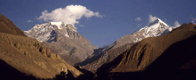
Finally after a long day appears Muktinath Ranipuwa. On the left is the Daulagiri
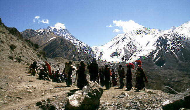
Thorong La with monks from Dzong
Links on this side http://www.high-altitude-medicine.com/AMS-medical.html
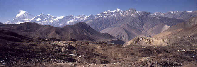
Overview Annapurna region 34 Khangsar to Thorong Phedi
Leibe deutsche Leser, bitte wechseln sie hier auf die deutschen Seiten   To the page To the page
|
||||