|
Nepal, Trekking around Annapurna - the Manang side
 Annapurna Circuit: on this page you will find information and pictures of the
northern trail from Muktinath to wonderfull Kagbeni Annapurna Circuit: on this page you will find information and pictures of the
northern trail from Muktinath to wonderfull Kagbeni
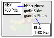
you can enlarge most small pictures by clicking in on of the corners.
If you want to see a picture in full sizze, click additionally on F11
NATT-trail No. 50. Along the northern trail though the picturesque villages Chongur
, Jhong and Putak to Kagbeni.
This is a highlight of the AC for everyone who is interested in Tibetan like culture of the upper kali
Gandaki valley. In the same time you will see clearly the Thorong Lain full splendor and have beautiful views on Nilgiri and Daulagiri Range.. Partially you will walk on a dirt road, but with so few
vehicles per day that they will not bother you. (in 2011 we saw just 3 in a whole day!)

Part 1: from Muktinath Ranipauwa to Chongur
The trails begins just on the left below the arc on the way to Muktinath temple area. The
ACAP sign does not say Chongur but Choinkhar, which is rather funny, as people of the village definitively call it Chongur . It is just a little rather unspectacular trail. You will pass a
little Electric hydropower unit which formally produced the electricity for Muktinath and Ranipauwa. Nowadays all the villages are connected to the general grid.
Soon you will see the colorful village of Chongur on the other side of the Jhong Khola.
When you crossed it you will come to some little chortens and reach the village through a little forest.
All the three villages are connected by a dirt road with very little traffic. Fortunately the road
contours Chongur so that you will enjoy a pristine traditional village in the style of Tibetan-Nepali culture. It will give you already a good feeling of upper Mustang. This area is called
lower Mustang, but you don’t have to pay the very expensive fees of upper Mustang
Chongur has an upper and lower part
The colorful houses of Chongur
View from Chongur over the Muktinath valley with the Daulagiri
A long time ago a monk came to the Gompa of Chongur and he was from the Buddhist
Sakia line. Sakia is a Monastery in Tibet and has the colors Grey, red and white.
The people were so fond of this monk that they started to paint also their houses in the colors of Sakia which make it unique in the area.
Agriculture
In this high and dry area people grow mainly barley, buckwheat and sometime potatoes.
Also sheep and goats are raised. The fields are in terraces and must be irrigated. The animals are brought by the village herder to meager, nearly dry grasslands. As al the sheep
are marked with color the can be later easily separated.
Ploughing is done with the help of oxen. The famer sings and whistles a song which tells
them when to pull and when to turn. This makes it a very pleasant walk in November or December when the entire valley resounds of the ploughing people.
N
The Gompa of Chongur
When you enter the village you see directly this deep red and beautiful Sakia monastery.
Normally it is always closed but it is worth to ask people in the village if someone has the key and could show the Gompa. Most of the gompas has no resident monk or nun but
some people of the village take care of it. They come every day to renew the water in the offering bowl, light some butter lamps and clean when necessary. The monks will come
only for bigger ceremonies. Don’t to give a donation for the Gompa and a tip for the person showing it to you. The gompa of Chongur is definitively worth waiting for an half hour !
Just on the other side of the road is a big white building. The two ladies offer tea, soft drinks
and noodle soup. They have a gorgeous terrace with an awful view. But there is no Lodge sign and you will have to knock on the door an hope that they are at home..
Continuing to Jhong
First you go to the lower part of Chongur and climb up a little trail behind a Mani wall. This
will lead you to a nice viewpoint from which you descend to a bridge, crossing a little river which has been carved deeply into the soft sandstone.
After the bridge you will walk on a dirt road but with so little traffic, that you will not be bothered.
Jhong (sometimes writen Dzong)
Auf dem ganzen östlichen Hang zieht sich ein großer trockener Hang hin. Ab und zu wird er von einigen grünen
Flecken unterbrochen , wo die Einwohner mittels Bewässerung ihre Felder anlegen konnten. Jhong sticht dabei
besonders hervor, denn auf einem Bergrücken, der weit ins Haupttal hineinragt, thront ein großes und weithin sichtbares Kloster und die Ruinen einer einstmals sicher sehr beeindruckender Festung.
Jhong oder Dzong
Dieses Dorf bildet die Mitte der Perlenkette mit den drei schönen Dörfern Chongur, Jhong und Putak welche
jetzt Muktinath und Kagbeni verbindet. Noch vor wenigen Jahren war die Verbindungsstraße nach Kagbeni für Touristen gesperrt, weil man schon durch das Gebiet von Upper Mustang mit seinen sehr teueren Trekking
Permit gehen musste. Die Einwohner von Jhong hatte allerdings schon länger erreicht, dass man ihr Dorf auch ohne spezial Permit besuchen dürfe und seit wenigen Jahren darf man jetzt die ganze Verbindungsstraße
heruntergehen, die im Norden von Kagbeni mündet. Aber auch wer nicht die ganze Strecke gehen will, man kann eine sehr schöne Rundtour nach Jharkot machen.
Wenn man von Chongur nach Jhong geht, kommt man an einer kleinen Mönchsklause am Hang vorbei. Die
Bewohner von Jhong sind noch sehr ihrer buddhistischen Religion verbunden und fast jedes mal , wenn ich nach Jhong kam, fand in der Klause ein Puja oder im Dorf eine größere Prozession statt.
Die Frauen von Dzong beim gemeinsamen Beten an der Klause, als ein Lama in das Dorf gekommen war und dort eine Puja abhielt.
Kurz vor dem Dorf kommt man noch oben erst an einem großen grauen Haus vorbei. Es ist die Schule und wie
in Nepal so üblich ist sie etwas vom Dorf entfernt und auf einer Anhöhe gebaut. Ich vermute, dass man das extra macht, denn so müssen die Schüler erst mal eine Weile laufen und können so schon mal ihre
überschüssige Energie abbauen und sind dann im Unterricht nicht so wirbelig. Die Lehrer wird’s freuen ;-) .
Anschließend steigt man dann in das nordwestliche Ende des Dorfes hinab und kommt direkt in der größten Straße des Ortes an.
Overview Annapurna region

NATT 40-Muktinath 
NATT 43-Purang Jharkot
 NATT-50 b Kagbeni NATT-50 b Kagbeni
  To the page To the page
NATT- guidebook and maps 
|


