|


|
Nepal, Trekking around Annapurna - the Manang side
you can enlarge most small pictures by clicking in on of the corners.
NATT trail N0. 32 From Sheree Kharka to Tilicho Lake, 2,5 h The side trek to Tilicho Lake will take a few additional days but it’s an unforgettable experience. With the new lodges it is also much easier than before. Before starting ask in Khangsar which lodges are open as they might be closed in the off-season. As the owners are from Khangsar they might even go with you to open it.
The Yak Herders It was in December 1998 that i went for the first time to Tilicho Lake. The lodge at Tilicho Base Camp was already closed but the tenant was so friendly to come with us from Khangsar. On the way to base Camp we came across a little yak herders hut, who still where there for a few days before returning to Khangsar a few days later. Like this the yaks could still live from the dry grass and the thorny shrubs. The longer the better, as hay is scarce in these villages. normaly Yak are very peaceful, but sometimes they attac people- so be carful! We were directly invited for a salted butter tea and some delicious Buckwheat chapatti.
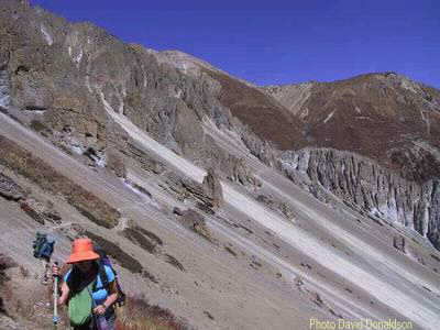
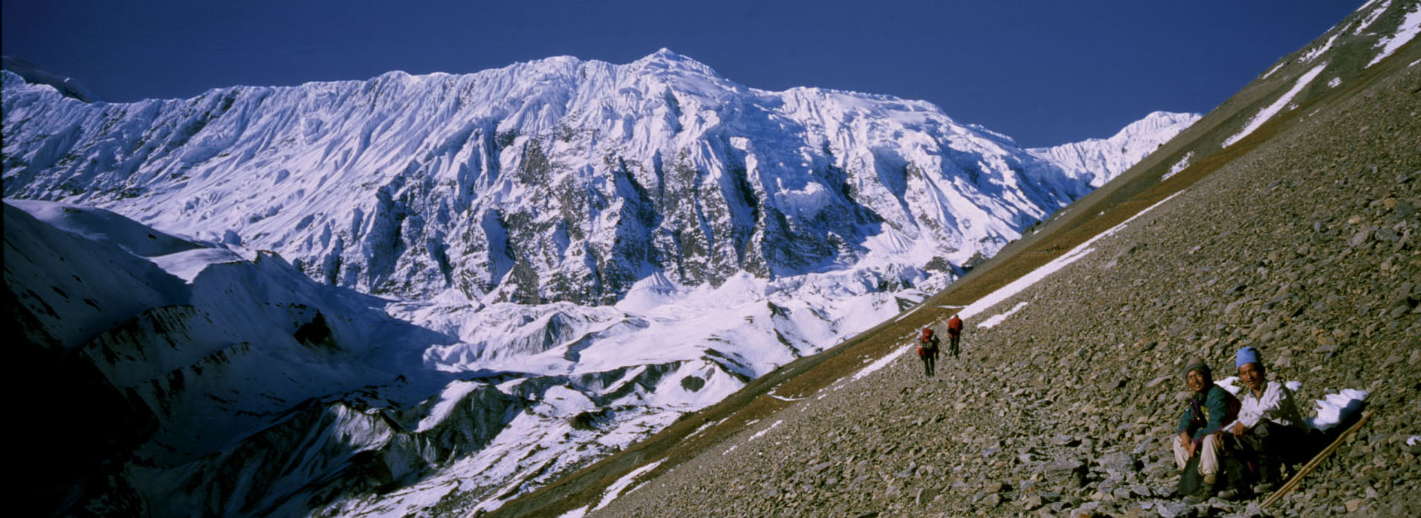
Continuing to the Tilicho Base Camp Lodge There is a difficult part of the trail passing along a steep gravel slope above the river. On this part of the trail there is quite often heavy and very dangerous rock fall. It mainly starts when the sun is heating up the rocks above and increases greatly after mid-day. For safety reasons it is advisable to pass this area only in the early morning. Make sure, that there is always a distance between one trekker and the next. If there are rocks falling it is easier to avoid them if there is space between the people. Once a fist-size rock fell just one meter behind a friend of mine; it could easily have killed him!
. Foto David Donaldson The Tilicho Base Camp Lodge
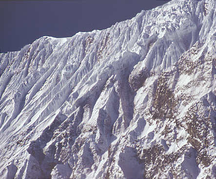
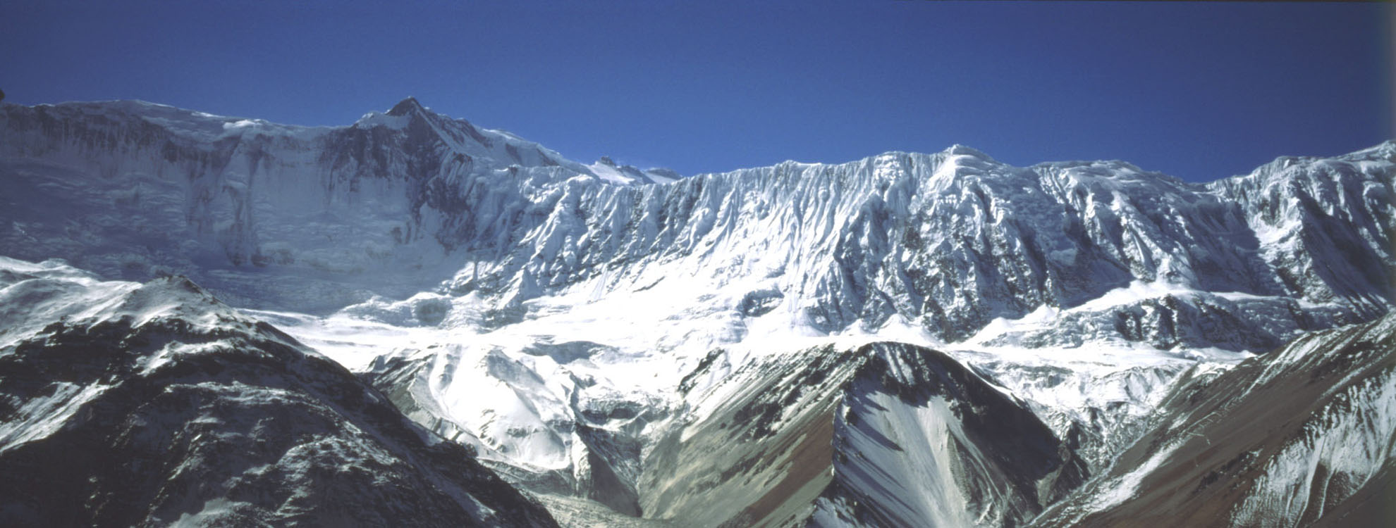
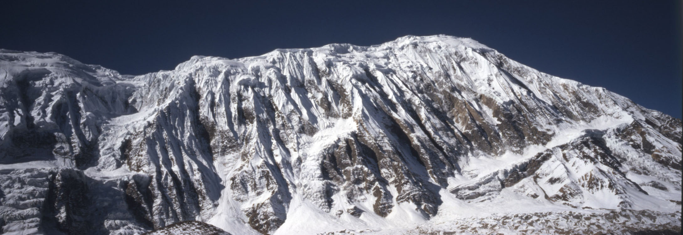
The grande Barrière
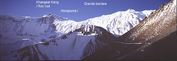
The “Grande Barriere” is a brethtaking ridge full of ice going from Khangsar Khang to the Tilicho Peak.
The “Grande Barriere”
When they had passed Tilicho Lake they were just before the Grand Barriere and had to understand that this was definitively an unsurmountable barrier. They went down to Manang hopping to get some food but the Manang people were so poor that they could not share any so the two French had to return hungry and empty handed all the way back to Marpha.
It’s wall is so steep the neither snow nor ice can stick to it. The ridge going north from it leads to Annapurna 1
Der Tilicho See aus dem Weltraum gesehen
1) Annapurna I, 2) Tilicho peak, 3) Khangsar Kang or Roc Noir,
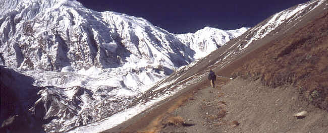
Going up !
Allow yourself a few hours at the lake. In any case it is not recommended to take the trail from TBC Lodge along the gravel slope when the sun is heating the rocks- this is a really dangerous area with a lot of rock fall. So plan just a full day and you will have the time to enjoy the magic of the lake. Very often there is a very strong wind up there, so don’t forget a scarf and cap and very warm clothes.
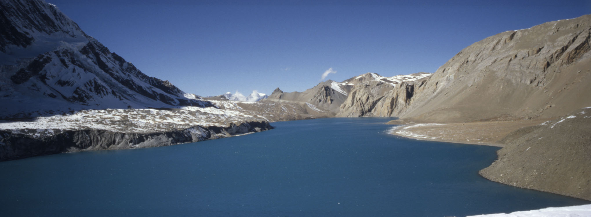
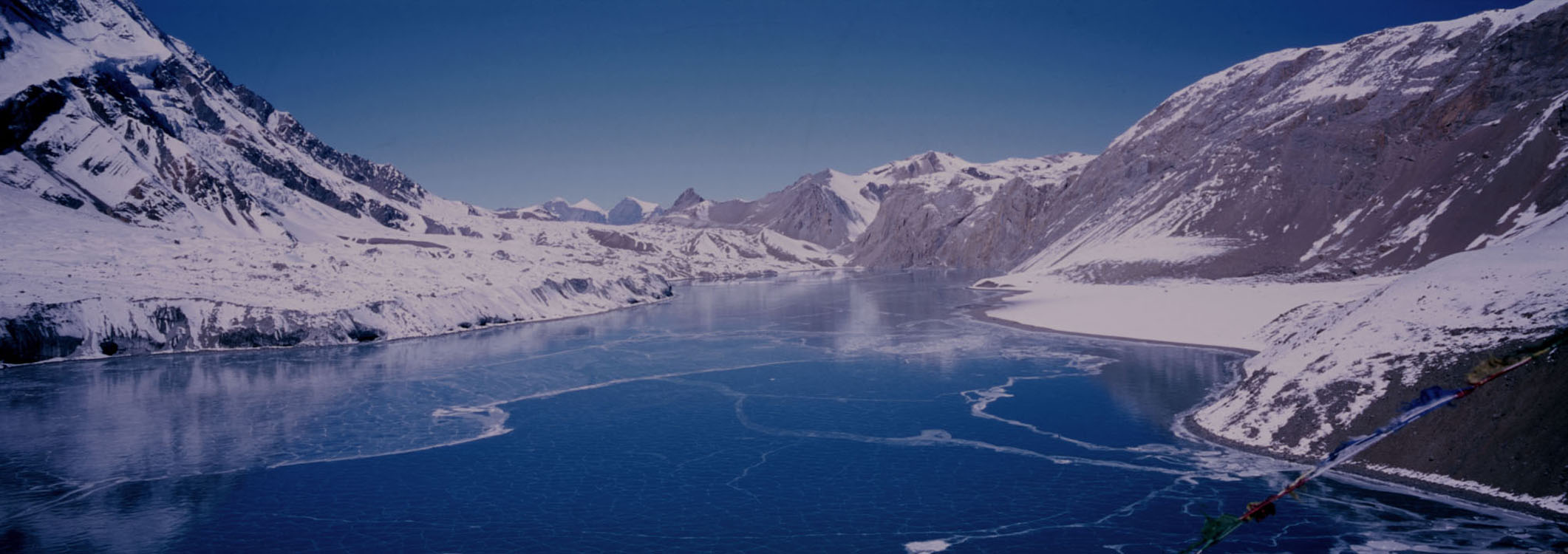
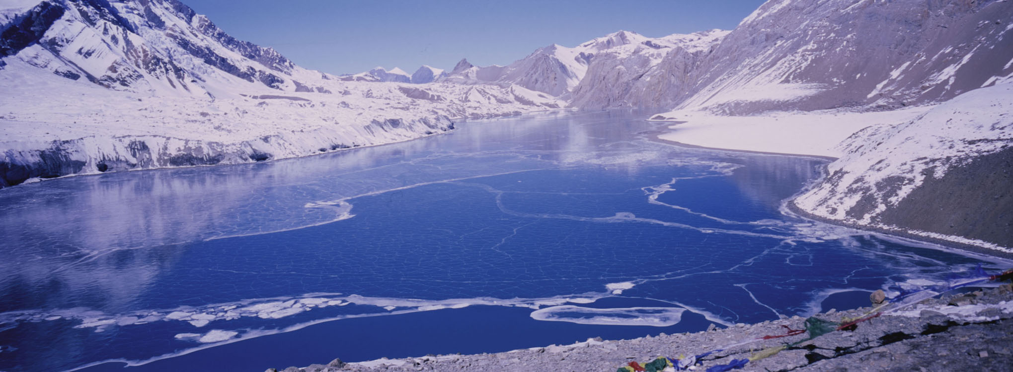
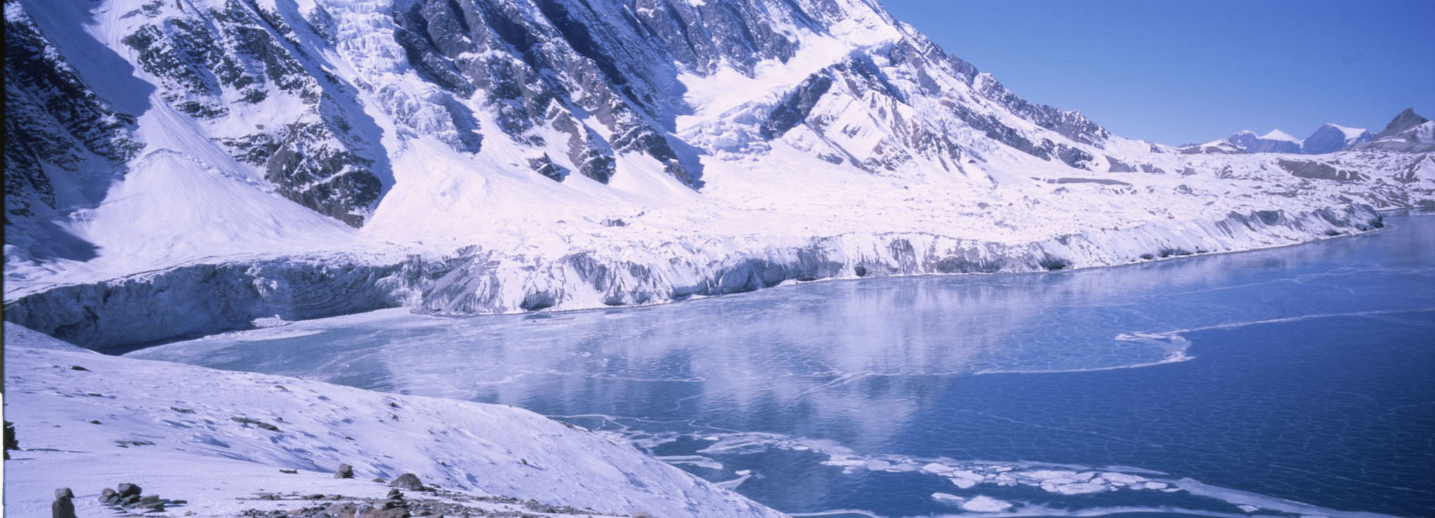
Tilicho Lake in October
Tilicho lake in October 1999 (4919 m) im Oktober 1999, on the left side one can see the glaciers below tilicho peak Bild XXL On some maps you still can see a trail going on the south side on the glacier along the lake. This is absolutely nonsense and dangerous as there are often avalanches coming down from the rock face of Tilicho peak. I have seen once an avalanche going right into the lake!
.
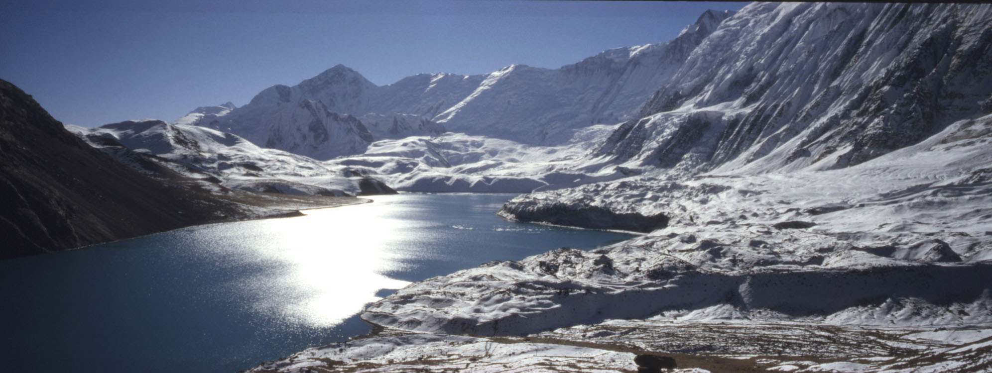
Am Westufer
Der See vom westlichen Ufer aus gesehen Foto XXL
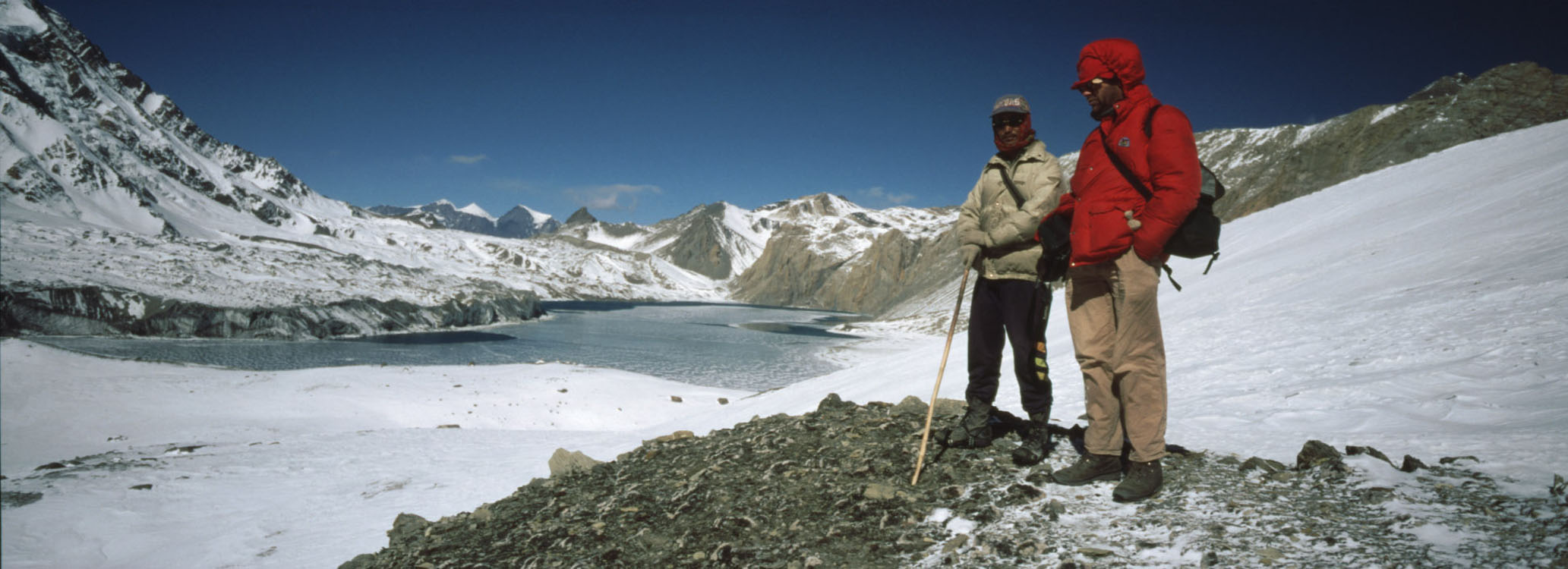
with my friend Bachan Rai
the rock wall of Tiliicho Peak Bild XXL .On some maps you still see a trail going around the lake on the northern side. This is also absolutely not possible as at the western part of the lake a huge cliff makes any forthcoming impossible. People of Khangsar had started to carve out a trail in the cliff, but they stopped before achieving it. But it is a good walk which offers great views and great photos.
On this photo one can see the new trail which stops dead at the lase decisive Cliff. it might be possible to walk on the ic eBeginn of March but i myself would not dare to take the risk. Photos Prem Rai Mai 2014 Tilicho Tal during the year Mid December
Mid December 1998 , there was so much snow that we could not reach teh lake Bild XXL
----------------- December 2005, much warmer then in 1998
Mid december 2005. Just a little bit ice on the lake. Bild XXL But we hade to walk the last 30 min in Snow
Photo Tilichosee XXL zum scrollen
With our Nepali Crew led by Bachan Rai we had already contourned Manaslu
Foto tilichosee XXL zum Scrollen March
The magic Tilicho lake in March2001 Photo Richard Beatson May
Tilicho Lake mid May 2014 Photos Prem Rai
Overview Annapurna region
  To the page To the page
|


 Der
Der 


