|


|
you can enlarge most small pictures by clicking in on of the corners. on this page not all photos can be enlarged
More and more People choose this side trek which will bring you to the traditional Tibetan-style villages of Naar and Phu(gaon). You need a special permit which is only issued in Kathmandu for at least two persons supported by a trekking agency. It is normally a tent trek which will takes around 4 to 5 days. But already you might find some shelter in Teahouses or basic lodges or homestay. The starting point is Koto and you return to the Marsyangi Valley over the high pass Kang La (5312m). A typical itinerary would be as follows: Day 1: Koto to Meta (3630 m) , Day 2: Meta to Phu (4065 m), Day 3 Phu to Mahendrapul(3500 m) or Naar (4190 m), Day 4: Naar over Kang La (5312 m) to Ngawal (3680 m). One can easily spend an extra day in the vicinity of Phu. As i havent been there yet i’m very happy the Uros server send a trail description. he was there in 2004 so things may have changed a bit. The starting point is Koto
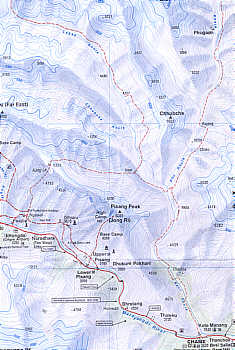
Map: Annapurna round from Himalaya karthographische Institut (1996)
see his Website
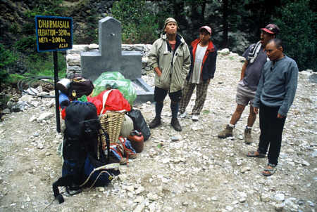
Trekking to Naar und Phu and over the Kang La (Photo Uros Sever)
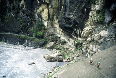
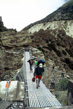
soon after koto the trail leads through an narrow gorge. (Photo Uros Sever)
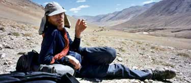
Dreamteam (Photo Uros Sever)
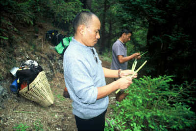
The crew collected bamboo sprouts for dinner (Photo Uros Sever)
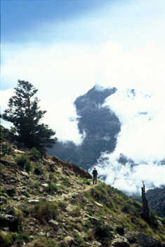
view of Pisang Peak on the trail from Metha to Juman Goth
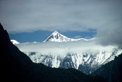
Lamjung in Monsoon (Photo Uros Sever)
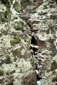
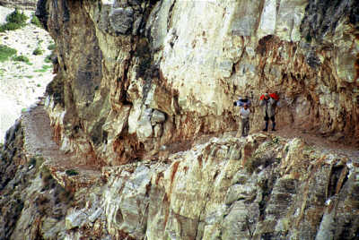
in the map they write "Dangerous rocky path" gespochen. But it has been enlarged (Photo Uros Sever)
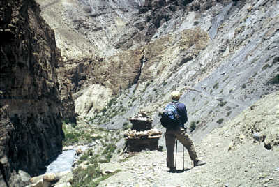
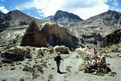
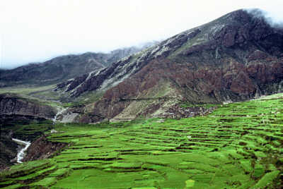
The valley of Phu Khola before the climb to Phupi Yalgoe. (Photo Uros Sever)
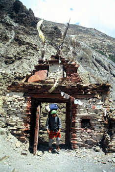
Ganga in Phupi Yalgoe - The entrance gate to Phu Valley (Photo Uros Sever)
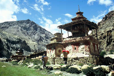
Chorten in Kyaung. (Photo Uros Sever)
Mani walls on the way to Phu (Photo Uros Sever)
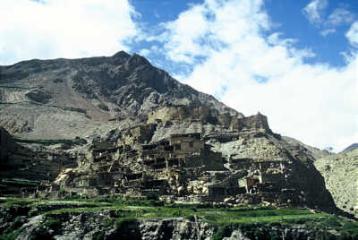
Phu (Photo Uros Sever)
Phu seen from Thashi Gompa . (Photo Uros Sever)
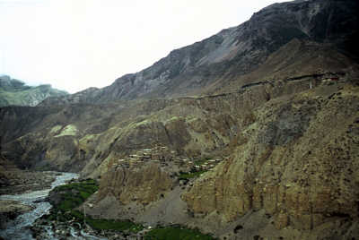
Naar Phedi. (Photo Uros Sever)
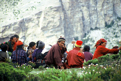
villagers from Naar return from a Puja in Yunkar gompa (Photo Uros Sever)
The village Naar (Photo Uros Sever)
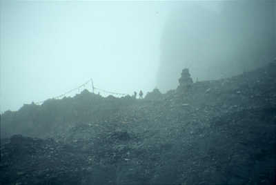
Trekking in monsoon - Kang la. (Photo Uros Sever)
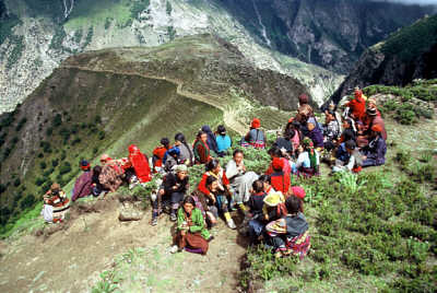
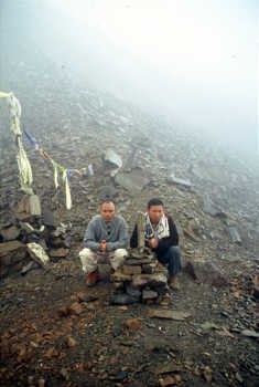
Puja on Kang la (Photo Uros Sever)
Nar & Phu trek by Uro Sever Geographic names follow Paolo Gondoni NAAR PHU Nepa map - 1:60.000, 950Rs, available in KTM, Manang...) There are all new bridges built by ACAP and path is well maintained and comfortable. Water supply might be a problem. There are 2 unattended open huts at Singenge Dharamsala for shelter and building of one was going on in Kyang by ACAP. There are no lodges on the way and in Phu, in Naar there are 3 lodges. In abandoned Khampa settlements along the way it is sometimes possible to get very basic shelter in uninhabited huts (but obviously used occasionally by sheperds). Period of trekking: July/August 2004. Recommended period: September.
Route description: After checkpoint in Koto descend to Marsiyandi and cross the bridge. The path enters Naar Phu Khola gorge and stays on its right (orographic) side for some 2 hours. Cross new bridge and soon cross a stream coming form a side valley. (if I remember correctly there is a new bridge higher up but we crossed small bridge. On the other side is the first camping site. The Nepa map shows here another bridge&river crossing but in fact the path ascends high above river and descends again. Here I stop following the crossings of the stream but there were quite a few always accross new bridges. The walls of the canyon are steep and the stream is blocked by large rocks. The map counts them as river obstructions 1 - 4. Just before Singenge Dharamshala (3.220m) the path leads behind sizeable waterfall. It is about 7h walk from Koto to Dharamashala. There are 2 houses here: new and old one. It is convenient for locals from Phu to stay here overnight on the way to Marsyandi valley or back. There is not much more here than a roof and a water source. nearby. Soon after Dharamshala the ascent to Metha begins. The path climbs away from the river. Metha (3.560m) is the first of a few ex-Khampa settlements on the way. Water is not so close in a sidestream coming from Kangguru Himal (6.981m) slopes. Now the path become level. On the left Pisang Peak is rising high above the river. You can see the bridge crossing narrow deep canyon at Naar Phedi and initial curvs of the path to Naar. Side valley of Dho Khola leads to Mustang. Going to Phu you have to stay on the true left bank high above the river. Soon you reach Junam Goth - another ex-Khampa settlement. After Junam the path descends steeply to the side valley with two paralel streams. There is no bridge across and in the afternoon water of the second was high, wild and brown while the first stream had clean water therefore we camped on a small beautiful grassy ledge above the first stream, 4-5 hours from Dharamshala. Next morning second stream was still fast but negotiable. After crossing the path ascends to Lower and Upper Chyako, again abandoned Khampa settlements. On the way back we were searching watersource intensively far around Chyako but could not find one. From the small ridge above Chyako the path traverses a steep slope then descends to Mruju Khola to cross it on a good bridge, climbs up again and finnaly descend to Kyang (4.000m), again abandoned settlement. There were workers here building another dharamshala. To better acclimatized we decided to camp here. Watersource is some 20 minutes walk away. Kyang was just some 3 hours walk from our last camp. From Kyang Nepa map describes a path as "dangerous and rocky" but even it is cut into sheer rock face it is wide and comfortable. After 3-4 hours the valley is blocked by huge wall and very steep climb take you to Phupy Yalgoe "Phu Valley Entrance Gate". Soon after the valley widens. After the bridge there are some old chortens and mani wall. Phu village (4200-4300m) is perched on the hill on the confluence of Phu Khola with a side stream. The houses of the village are well maintained (better than in Manang) and it is quite lively in Manang. There is a camping site by the river but we stayed in the village camping in an outside yard (we payed to the owner for camping and for using a small stone hut as kitchen). It is about 5 hours from Kyang to Phu It seems yak husbandry is prevalent here. But Phu people tend to migrate to KTM or even to go to work in Indonesia like the owners of our campsite. On the other side of the side stream there is qite sizeable Thashi gompa. We visited it during exstensive puja which mostly local women attended. We were recieved warmly got a seat in the praying hall and were offered salted tea. Side valley is the way to Tibet which in the past locals could reach in 3 days but we were told the route was dangerous due to glacier crossing. It is possible to follow Phu Khola further to reach yak pastures (kharka) in the base of glaciers. On the way back we went all the way to Junam Khola. We were lucky, this time second (now first) stream was clean and first (second) stream was rushing wildly therefore we could camp&use clean water. Next day we descended to Naar Phedi to cross the bridge. It is interesting to observe the structure of now ruined old bridge - looks like really neckbreaking building craft. Initial climb winds uphill in a series of long hairpin bends to the scenic teraces. After some more climbing the level path leads above terraced fields to the Naar village (4 .110m). Again houses appear very neat with interesting details. We stayed in the lodge - a bit more basic than AC lodges but fine. Approx. 5 hours from camp to Naar. We decided to go only to Kangla Phedi (4.530m) or Kang la pass base 2,5h from Naar. The path follow wide level valley - yak pastures with many grazing yaks. It is 3 hours from Phedi to the pass, sometimes quite steep. Initial descend from the pass to Ngawal is quite steep and could be dangerous in hard snow. It is a looong descend to Ngawal on the upper Pisang - Manang route.
Some more information written in http://trekinfo.com/forums/showthread.php?t=2469 You need a permit (beside ACAP permit) to enter Naar Phu area. The price was 70 usd per person for 1 week but it was said the price will soon change therefore 90 usd should be correct price. You can not get a permit individually. It is issued by Immigration office in KTM only. Agency has to provide quite some papers to get one (registration papers, staff insurance, even a list of food supplies etc.). The recipe to make it cheap is to find an agency which will apply for permit. You dont have to bring guide, cook, all kinds of assistents, mess tent, toilet tent etc. what is usual on organized agency trek. I just hired 4 porters from the agency (insurance!) who brought their own tent, stove, basic food etc. so the whole tour was not much more expensive than trekking from lodge to lodge. One porter was actually a lycenced guide but in fact he did not act like one since he had not been in the area before (and I dont want to have a guide when I am trekking on my own). But formally our trek was organized by an agency so policemen on the checkpost should be satisfied (although when we entred the area there was nobody there to check). Probably there is a misunderstanding on Yetizone forum about same topic. Liason officers are no longer required on treks in restricted areas but treks have to be organized - it depends on your arrangement with the agency how much staff you will have but I guess at least there should be a guide. That there are no more checkpoints in all maoist controlled areas is another issue. Timing: we were there in second part of July, beginning of August 2004 - monsoon time and I enjoyed walking by Marsyandi - very green, huge moisture, lechees, empty routes&lodges, Manang valley all pink from flowering buckweath. But I would not recommend it for the first timer on AC since views can be obscured for days and it is rather strange doing AC without seeing Annapurnas. Thank you Uros Maps from Himalayan Map house/ Nepamaps
There is a possibility to reach upper Mustang by the Naar Phu area or make a long trek with severel additional high passes in the area. Both trek are rather an expedition and require tents , porters and a kitchen crew.
Overview Annapurna region The former trail by Latamarang Chame to Bhratang to Dhukur Pokhari   To the page To the page
|